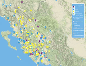
Interactive Map
In progress: the map currently illustrates only the region of Epiros, and will gradually expand to include Thessaly and Macedonia.

To open the interactive map click on the map image to the left or open interactive map
The map will open full screen in a new window.
The map displays sites in ancient Epirus. It will gradually expand to Thessaly and Macedon.
The labels and data collection method
The project collected data exclusively for archaeologically attested archaeological sites, which have been either excavated, or located but not excavated. Sites attested from literary evidence only have not been part of the database.
1. ID: The number that we have allocated to each site.
2. Name: Each site is labelled with its modern name accompanied by the ancient name in brackets if known, e.g. Finiq (Phoinike). If the ancient name is not certain it’s written as Site name (?)
3. Site_type:
For the identification we follow the excavation reports.
- Settlement: fortified or unfortified site where remains of dwellings have been found
- Fortification: fortification circuit where remains of dwellings are not confirmed
- Tower: building in the form of a tower that was not part of a fortification circuit and functioned as a watchtower or/and fortified residence
- Farmstead: building possibly of commercial-farming character that cannot be related to a settlement on the basis of the currently available evidence
- Temple: for temples out of settlements or that cannot be associated with a settlement
- Graves: Cemetery with well understood limits or cluster of graves or isolated grave. The label is used for all the previous when it is not possible to associate them with a particular settlement. Graves that were part of a known settlement are not recorded separately.
- Funerary monument: Monumental tomb in the form of a built structure (usually labelled as ‘heroon’ in the bibliography) or built burial enclosure (peribolos)
- Tumulus: when it is not possible to associate it with a settlement
- Group of finds: the category refers to pottery deposit, blocks and fragments of buildings, sculptural fragments, inscriptions, coin hoards etc. when it is not possible to identify the type of site
- Building(s): building remains in situ when the function cannot be identified
- Quarry
4. From: Stands for ‘inhabited or used from [date]’. Time period is listed when the century is unknown. If more precise date is known, it is stated as ‘quarter of x century’ or ‘half of x century’ ‘early x century’ etc.
5. To: stands for ‘inhabited or used until [date]’ (see above for date format)
Dates follow the current publications.
Data collection sources (in order of priority):
- Published excavation and survey reports
- Longer published presentation of results by excavators (archaeological guides of sites, contributions in edited volumes)
- Secondary bibliography (commentary-presentation-summary by scholars other than the excavators)
- The seminal works of N.G.L. Hammond for Epirus, S. Dakaris for Thesprotia, Kassopaia and the Elean colonies have been consulted for sites that have not been excavated. These were cross-checked with the ‘Ongoing Catalogue of the Listed Archaeological Sites and Monuments of Greece’ of the Greek Ministry of Culture and Tourism-the Directorate of the National Archives of Monuments for sites located in Greece.


